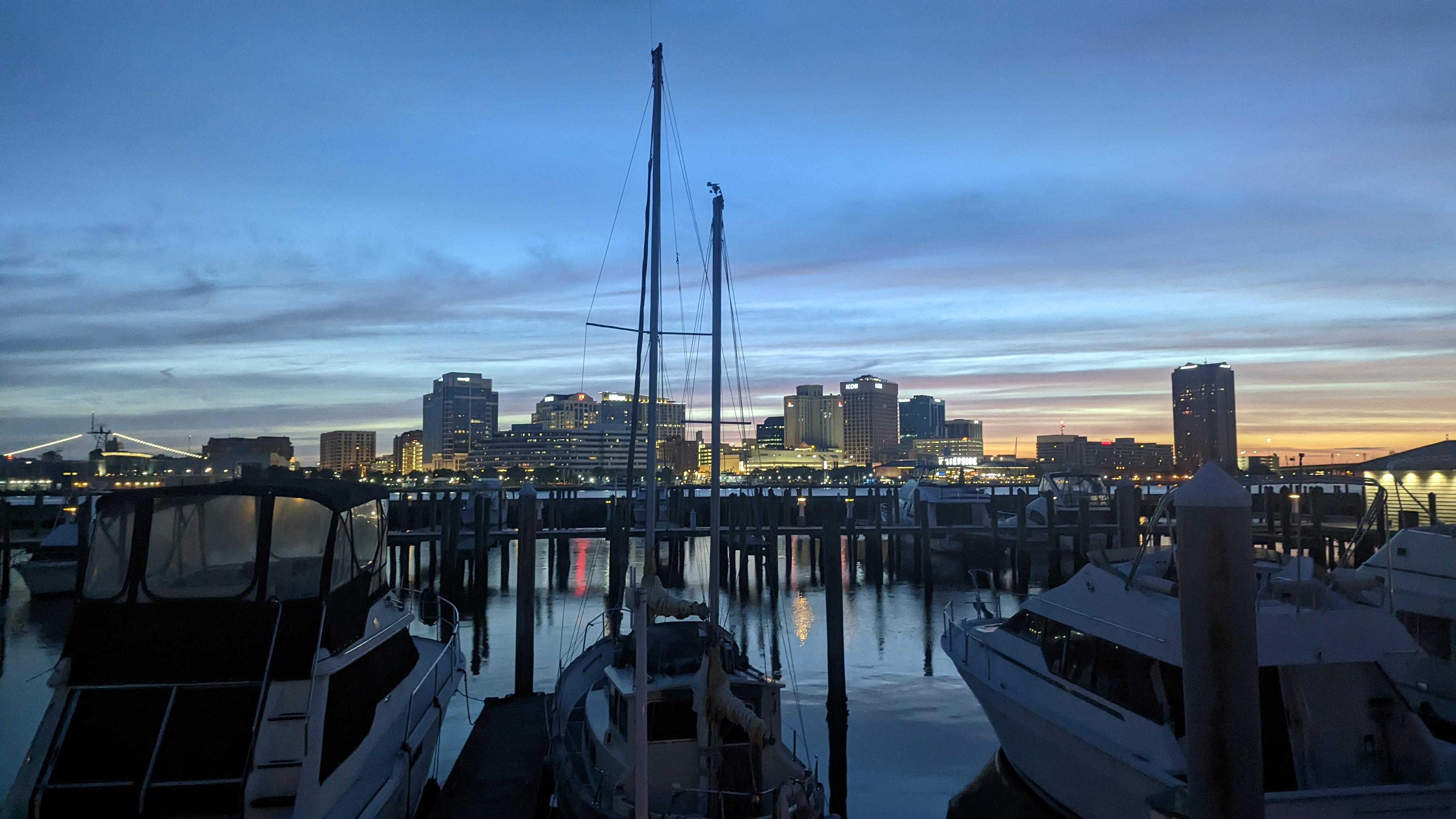
Where we at

Tuesday, April 25, 2023

Hangin' in Norfolk

Sunrise in Norfolk
It's not uncommon to run into (not literally!) fellow boaters you've looped with or met in your travels. But for whatever reason this has been a big "Class of 2019" looper year. A number of boaters that looped that year are headed in the same direction at the same time. 

Dinner at the Bier Garten
Sonya, Trish, Greg, Jamie, me and Russ
We needed a place to dock inQuest for a few weeks so we can travel to Florida for a bit. Norfolk worked perfectly for that. While walking the dock I noticed Golden Daze (Sonya and Greg) hanging out on their back patio. The next day No Rush (who we anchored with in Georgetown) joined us. We gotten together for a number of meals, and even went to a museum.

We took a lovely walk through Ghent.
a suburb of Norfolk
They'll started heading north today. I'm sure we'll catch up with them by the end of May.
The USS Wisconsin, at the museum

Russ looks small standing between the battleship's
anchor chains.


Thursday, April 20, 2023

Dismal Swamp the Norfolk, slip (!)

Waiting for the lock... oh bother!
This wasn't a long day but it was pretty busy. Up around 5:30 (getting light already at that time!) we had some coffee then headed to the north lock, Deep Creek Lock. We arrived about an hour early, all part of our cunning plan to get some waffles! Before the bridge there's a small dock, and just beyond it is a grocery store, a Hardee's, and a Waffle House. Guess which we got. Once docked Russ ran over and got 2 pecan waffles to go.

Wee hours on the Dismal
The lock master here was very enthusiastic; answered our hails (from a hand held he used while driving to work) and gave us instructions -- follow the sailboat in, port side tie, wear PFDs, and engines off please. We like this guy, having been locked with him before. He enjoys his work.

Once down 8 feet and officially off the Dismal we made our way to Top Rack. They have the best fuel prices. We filled up and pumped out then headed to Tidewater, an actual marina. And there... we plugged the boat in.

Norfolk! Well, the industrial section.
I want to point out that we haven't plugged the boat in since we left Longboat Key, almost a month ago. Since then we'd been on mooring balls for 3 nights, and on a free dock for 2 nights, but otherwise we'd been at anchor. I also want to mention that, during that time, we ran the generator 3 times. Otherwise the boat's been powering itself. That's been awesome! This has been a great trip so far.

This was the first time ever we didn't have to wait
for that stupid railroad bridge!

Russ got us the slip for a month. We doubt we'll stay that long, but we definitely needed a couple of weeks. We will rent a car and head back to Florida to celebrate my dad's birthday, then spend a few days at Disneyworld. 

Then we'll be back at it.

Wednesday, April 19, 2023

Tuckahoe to... somewhere on the Dismal Swamp, dock

It's been said you cannot make plans when boating. Things frequently don't go as planned, so in addition to that "plan A" you'd better have a "plan B".

Or, in our case, a "Plan E."

Plan A: Get up early and get the Albemarle done. That part went very well. Winds were higher than expected but from the NE, which meant we were taking waves on our quarter bow. Catamarans love that. The heights were around 2 feet at the beginning, then dwindled to under a foot as we progressed. Great crossing. So all we had to do was get up the Pasquotank River and onto our favorite free dock, get some water, do some yoga, take some naps, go to the brewery, grab some dinner...

Early up and out
We like the little dock behind the little University in Elizabeth City. When we first started boating and did the loop, staying in the town docks was "da bomb". Those were free, close to town center, and the locals hand out flowers to welcome boaters. In the last couple of years, however, they fell into disrepair, some bound with yellow "keep out" tape. Also, if the weather is coming from the south (not the case now) they can be bouncy. They had tiny (read that "useless") finger piers, making getting off the boat a challenge for most boaters. Lastly, they were on the south side of the Elizabeth City Bridge which you have to time to leave in the morning. The university dock is 1) clean, 2) had a friendly dockmaster, 3) free, 4) on the OTHER side of the bridge and 5) a pleasant walk to town. I shouldn't be surprised it was popular. However, we arrived around 11 am and the dock was full, largely because lazy boaters hadn't left yet. Sail boats.... just sayin'.

Plan B, stay at the city docks. Plan C, go into the Dismal now and stay at the visitor center, which we always do. It was just a couple of hours away. We picked "C" and kept going.

The Dismal Canal is bounded by 2 locks, the south one (South Mills) and a north one (Deep Creek). They only open 4 times a day, at the same time (8:30, 10, 13:30, and 15:30). That's because water in the canal is rather precious. If both locks just opened whenever anyone wanted to the canal could be totally drained. Thus the schedule.

Hangin' out on the lock wall
Of course, we were going to arrive at the south lock at 1:40 pm, just missing the 1:30 lockthru. There are dolphins there, just outside, so we figured we'd tie to those, take naps, eat some lunch, and do the 3:30 lockthru. 

Using our AIS we noticed 2 boats behind us, following us onto the Dismal, one we looped with, Inshallah. We also saw a boat leaving the lock chamber heading north (so, that's one boat we're certain will be at the visitor center... and the dock holds 3 - 4 boats). Upon arriving at the lock we heard a boat hail the lockmaster, hoping to still make the lockdown. We didn't think (now that it was passed 2 pm) he would, but lo! He locked them down. Sadly, that meant we couldn't tie up to the dolphins because we'd be in the way of the boat leaving the lock. We stood station and waited. For 45 minutes. Oh... I have stories about this lockthru but this blog entry is already long... 

We've never thought the Dismal was
all the dismal.
Once the boat passed us we were making our way to the dolphins when the lock master just waved us into the chamber! So we complied. He wasn't going to lock us through, but was letting us wait in the lock. Very nice! We snugged up to the front to make room for the 2 behind us, and went to take a quick nap. 

The lockmaster clearly wanted to get us out of his way so he started locking us through at 3:20, and all 3 of us were back at it by 4 pm.

Turned out, not one but 2 (sailboats... it's always the sailboats!) were already at the visitor center dock. Inshallah was a larger boat. If we took some of the dock ourselves, they wouldn't have room. The third boat could easily raft to Inshallah. Yes, we could have just taken the spot ourselves but that didn't seem fair. We knew there were a couple of smaller docks up ahead. We hailed the following vessels and told them the situation and that we would press on.

Stuff you see on the Dismal
Plan D was the Lake Drummond Feeder dock which our documentation said was 17 feet. Looked way too small for us.

Plan E was the Douglas Road dock, which we've always thought looked cute. So here was our chance to try it.

By the time we came to a full and complete stop we'd been underway for over 12 hours.

Btw... we did have a Plan F. It involved waffles. We still may do that in the morning.
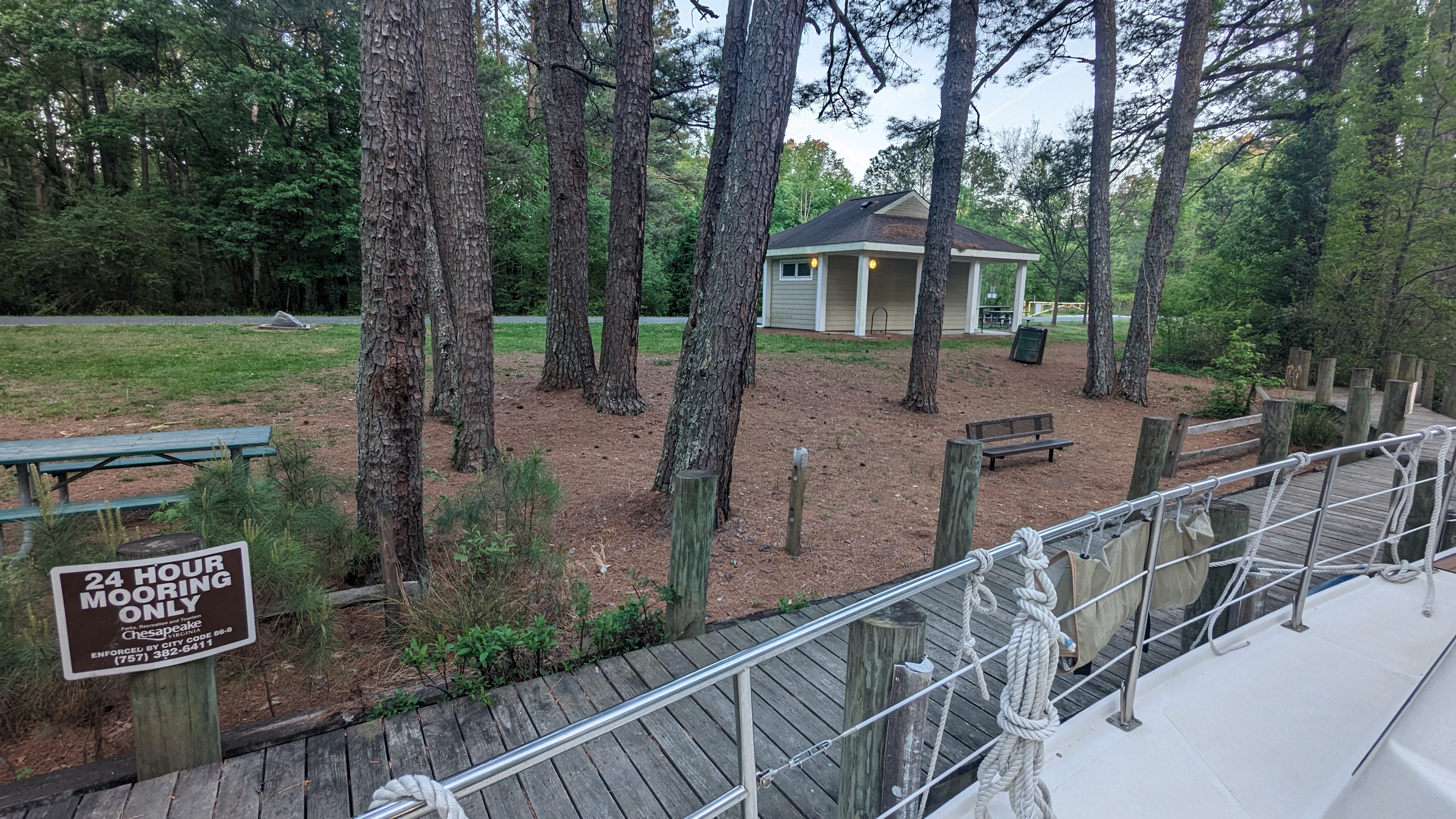
The Douglas Road dock. I told you it was cute!


Tuesday, April 18, 2023

Cedar Creek to Tuckahoe Point, anchor

Early morning out... 6:19 am!
Long long day! We made the push given the water was nice and tomorrow still looks like a great day to cross the Albemarle. 

Lots of bigger bodies of water needed to be crossed today. The first was the Neuse River. We've luckily never had an issue on the Neuse, but we've heard stories. We made a point of doing it early in the morning, when the winds are low. Today was no exception.

Gorgeous day, too. Calm on the channel,
20 miles between Pungo and Alligator.
Then we turn up Bay River, which can be bouncy but it usually not a problem. The next hurdle was crossing Pamlico River then going up the Pungo River. By the time we got there winds had kicked up and made the voyage a little beamy. 

This is us.
Once the river narrows into the Pungo and Alligator River channel winds no longer mattered. Which was good since they were over 25 mph.

Not many boats out and about, so travel went smoothly. 

Monday, April 17, 2023

Mile Hammock to Cedar Creek, anchorage

Given how early we left this morning we were NOT the first boat out of the anchorage. Mile Hammock is a popular spot for several reasons; pretty protected, large enough for a number of boats, and nice muddy holding. A sailboat beat us out, leaving about 20 minutes before us.

The trip went well. Breezy today, but that didn't impact us. We were in our favorite anchorage before it came up in force. We can see the Neuse from here, and, more importantly, listen to chatter from boats already on it. If all goes according to plan, we'll be out early tomorrow to cross the Neuse before the winds kick up again.

Once you leave Mile Hammock you go through a section
of land used for military games. Yes. That is a blown-up tank.

Tough to catch this with a camera but if you look at the screen, 
you see our track. And there's "land" to the right of us.
Looking out the window, however...

Click to enlarge, then look at top right box.
The info on the right tells us about the bridge coming.
Like that Onslow Beach Bridge we deal
with after leaving MHB which only
 opens on the hour and half hour.
It should be breezy tomorrow too but from a direction that makes doing the Neuse fine; we expect to have it on our stern, mostly. That leaves Wednesday (looking awesome wind-wise) good to cross the Albemarle. Then it's smooth going right into Norfolk.

For Boaters: Something new we've been doing with Aquamaps is "navigate" by Bob423's routes. This gives us details about stuff coming up, specifically bridges. We know how far away it is, what kind of bridge it is, and when we'll get to it, all at a glance. Very handy.


Sunday, April 16, 2023

Bird Island -> Southport -> Wrightsville -> Mile Hammock

Been a whirlwind of travel the last two days. Looking ahead we see a potential weather window to cross the Neuse River on Wednesday and we want to make sure we hit it. Thus the motivation to keep moving.

Bird Island was a decent anchorage. Not exactly calm, since we bobbed a bit throughout the night, but nothing drastic either. We slept well since we had great holding.

Then we set out to go to Southport. We docked at a restaurant that offers free dockage (so long as you eat there), then took the small hike to see Robert. He's a former looper and has helped us in the past. Seems we inevitably need something on this section of water. This time it was more engine belts. Because, you never know when you're going to need them.

Nifty to see the moon and it's reflection while a t-storm
it in the distance.

After spending some time with Robert on his front porch (I so regret not taking a picture!), we grabbed lunch at Provision Creek, then fired up the engines and headed up Cape Fear. The wind was up by then but on our stern, so the ride was lovely.

The goal was Wrightsville. We discovered that if you anchor close to the bridge there's a handy dinghy dock nearby. From there we could Uber to Walmart or Costco. That was the plan. However, from Carolina Beach to Wrightsville there were hundreds of little boats zipping by, making the trip intense. They'd come close to us while passing each other, never slowing. Moreover, right as we get into our anchorage there was a small regatta we had to avoid.

This isn't the worst section. We hadn't realized the camera
stopped recording. But you get the idea.

Needless to say, by the time we dropped the anchor, around 4 pm, we were pooped and unmotivated to do any shopping.

Looks like a clue that we're not supposed
to be here.
Today was going to get windy, especially through the night, so we opted for a shorter day. A looper favorite was Mile Hammock Bay, made for the military. Some have been here when they do maneuvers with amphibious vessels. The first time we were here we took the dinghy to shore to walk the dogs, a no-no it turns out. We didn't get in trouble, but knew we weren't supposed to be there when we saw signs for Tank Crossing.

Friday, April 14, 2023

Dewey Creek to Georgetown to Calabash, anchor

The trip from Dewey to Georgetown wasn't particularly long. But we knew rain was coming, and we knew there was a grocery about a mile from the public docks, and we needed some supplies. We hope to get that done before the rain.

We left the anchorage early. Of course that meant we hit the skinny, shoaled areas at low tide. We're so happy we have a shallow draft boat!

In the past we always docked in Georgetown. John of As You Wish mentioned anchoring there. That area is also very, very shallow. But just past the marina was a large pool, right in front of the not-in-use steel mill. Apparently that was where tows turned around coming and going to the mill. It was large enough that all of us (As You Wish, No Rush, and inQuest) could anchor there with room to spare.

(L to R) Martha, me, Russ, Jamie, Trish, John
We did our shopping, then we all had some appetizers aboard No Rush. Even the Legacy crew, Mary and Jim, joined us. Then we headed into town and tried a local brewery, The Winyah Bay Brewing Company (which was inside the restaurant, Buzz's Roost). Everyone is headed north, so odds are we haven't seen the last of each other.

The next day was longer for us. Russ has packages shipped to a friens in Southport, Robert Creech. They sprinkled in over the last few days. And we don't want to take advantage of his time and generosity, so we hustled north today. We'll see the them tomorrow morning.

We'd anchored in Calabash Creek a couple of times. I didn't like it either time. The anchorage is small and right next to a channel that leads back to a tourist town. Tour boats and fishermen buzz by often and, since the area is small, close to us. I always worry they'll misjudge an hit us.

But if you turn right instead and head toward the Atlantic there's a larger anchorage hiding behind an island. Probably not great in a big blow but should be dandy tonight. 

Early out on Dewey Creek

Mary took this when we brought them to No Rush

NO RUSH! Some of the gang already on board.

Rainy night, and drizzly morning in G-town.

Once the clouds parted it was a gorgeous day.
The Waccamaw River has some of the prettiest views
on the ICW.


Wednesday, April 12, 2023

Fenwick to Dewey Creek, anchorage

Not much to report today (which is how I like it!). The only trial was we hit Watts cut at precisely low tide, and it's very thin. The shallowest we saw was 2 feet beneath the keel. Mostly 4 and 5 feet. We had no issues, but saw visual evidence that others had! 

We crossed Charleston Bay today. It was the easiest time we've done it -- not a lot of boats, not a lot of wind, no choppy water. All and all the day went smoothly.

Legacy, sporting her gold looper burgee
While underway we got in touch with other boaters in the area that looped the same year we did. Tonight we're getting together with Mary and Jim of Legacy (they looped on the vessel Pegasus). Tomorrow we're hoping to hook up with Martha and John (As You Wish) and Trish and Jamie (No Rush, formerly the crew of About Time).


The class of 2019 travels again!

Russ points out where we saw some boat leave tracks


Tuesday, April 11, 2023

New River to Fenwick Island, anchor

We remained on the New River for 3 nights waiting out the blow. Yesterday, we texted boats we saw traveling on Nebo to ask how the water was. Their responses made us feel good about staying put.

The morning was clear when we brought up the anchor. Russ started to contact some marinas seeking a pumpout. Good thing he called, too, since our first choice (which was a Safe Harbor marina) had a broken pump. Skull Creek Marina was close by, easy access from the ICW, and a functioning pumpout. Bingo!

Dramatic sunrise and the storm moves off
leaving winds behind it.
After that our only bit of water churn was crossing Port Royal Sound. Still a little bouncy but nothing like what folks told us they experienced yesterday.

The only other excitement was "the dredge". The Ashepoo-Coosaw Cutoff was notoriously shallow. They dredged it this year, and are still working on the end we'd encounter first (so most of it was already done). But this dredge had already been an issue to some boater recently; Somehow they got caught on a line and did serious damage to their vessel, nearly sinking it. 

Once he made the turn, tons of water.
But tight in the channel.
We listened closely to radio chatter as other vessels hailed the dredge and asked for instructions. We felt pretty confident about what to look for as we got closer so I didn't think we'd need to talk to them. Until the tow showed up. The tow was pushing 2 barges the other way (heading south). I hailed the dredge asking if he needed us to stand station until the tow passed. "Yep, please stay put."

The American Star, one of the tiny cruise ships
that traverse the East Coast.
Watching the tow go by was impressive. The skinny channel was choked by the huge dredge and pipes strewn all over. But it went through fine, passed us, and we crawled by the dredge ourselves.

Just a little further we found an anchorage and dropped the hook. Decent day, all in all.


Monday, April 10, 2023

A special post...

(Updated with better video, sorry for the repost!)

We've stayed put for a couple of nights since our anchorage is offering decent protection from the blasting NE winds. Russ has kept busy with a lot of little projects, like changing belts on engines and moving our VHS radio.

And making a nifty video.

This is his first with any kind of editing, but it definitely shows the adventures our our foggy morning run leaving St. Augustine. YES, THAT GREEN IS OUT OF PLACE!


All charts showed it on the right.


Saturday, April 8, 2023

South Creek to New River, anchor

If you didn't see my FB post we had a small water issue last night. We're thankful we found it then. Our trip today was lumpy in places (positively bangin'!) and we never would have heard it break over the roar of the engines. We'd be seriously unhappy now.

We didn't get a great night's sleep last night. The winds were up and stayed up. Turns out the storm that wasn't supposed to arrive until Sunday came a day early. We were banking on calm winds to do the next 3 inlets. But that wasn't meant to be.

All our weather apps alerted us to gale warnings for Sunday, which was no surprise. However, they showed Savannah, Georgia as being the northern boundary. Now we had a goal -- try to get beyond Savannah. Thus the seriously long day.

Last night's anchor track
The first inlet we had to traverse was Sapelo Sound. The winds were coming from the North East, and so was the sound. As we made our way the waters got worse, taking it on the bow (which we hate), until we were in near 4 feet seas. At that point we had to turn northward, so now those seas were on our beam (which we hate more). That part only lasted 5 minutes or so, but was not comfortable. Once behind the island, everything calmed.

Nothing redeeming about the day.
Cold, dreary, windy as heck!
Armed with that experience I worried about the second and third inlet, St. Catherine's and Wassaw. We had backup anchorages planned if things got ugly. But they were vastly better than the first -- the sounds ran more southerly so we had decent protection from the islands around.

Few boats were out and about, largely due to the small craft advisories. On the ICW it wasn't that bad. The temps dropped drastically, however. When we woke it was around 66 degrees. Turned out that was the high for the day. By the time we anchored we were in the low 50s.

Turns out that gale warning was up here, too. Savannah wasn't a boundary, just local information. So we had a crazy long day for no particular benefit.

At least we made it to South Carolina.

Friday, April 7, 2023

Fernandina Beach to South Creek, anchor

Big, big, winds are coming this weekend, starting Saturday night. Wherever we are at that time, we might have to stay there for a couple of days. We're shooting for near Savannah.

The wind has been very calm in the mornings and getting worse in the afternoons (which is not unheard of). And that's why we like to get up and go! Which we did. We were across St. Andrews Sound -- one of the toughies -- long before any issues. We even got to wave at the American Independence cruise ship as we went by.

Zero problems today. The new Calex is working wonderfully, the sole Orion is about to get 2 brothers to help out this afternoon.

Two thumbs up for boating today!

Ah, Georgia. Where you can see all the boats
ahead and behind you!

You've heard of "Jack in the box?"
I give you "Russ in the cabinet."


Thursday, April 6, 2023

St. Augustine to Fernandina Beach, ball

While Russ managed to get our electrical issues working, to get it truly fixed required some parts. They were being overnighted to Fernandina Beach. We were up and out early.

Both our phones had alerts from all our weather apps that there was fog in the area. Totally clear, though, in St. Augustine. We've boated a bit in thick fog so neither of us were concerned.

Off the ball and on our way, we weren't but a hundred yards from the Bridge of Lions, having just gone beneath it, when we were socked in. We had the radar running, the fog horn going, running lights on, and Russ on the bow watching for channel markers while I drove the boat. The routine was me saying "Red marker coming up in 1/4 mile" and he tells me when he can see it.

I kept a keen eye on my maps, all of them. We use Navionics, Aqua Maps, and a Garmin chart plotter. 

The green shows on the right side.
Apparently it's been moved.
It was on our left.
And all of them were wrong.

I was making the turn out of the inlet to head north on the ICW. I just happened to look up and could see a green marker (that all my maps said was on my right) on my left. Confused I slowed, just as out of the fog were people! Russ started yelling "Back up!!!" which he didn't have to because, believe me, I was already doing it. Despite the fact that I could see BEACH ahead, we had over 20 feet beneath us. We never touched anything or anyone. But that was one crazy turn. I'm sure the folks fishing from the shore thought that was odd, seeing a huge boat appear out of the fog.

We had no issues the rest of the trip. The fog lasted about another hour and we did just fine.

We stayed 2 nights here, collecting the bits and bobs Russ needs to fix our electrical issues. New Calex, check! Three Orions, check! Hopefully, we'll run nice and smooth the rest of the trip.

What I see in a fog.
Yeah. Wishful thinkin'.

To keep the power load off the 12V system
Russ plugged in the fridges.

Sunrise in Fernandina